Geology of the Sierra Nevada
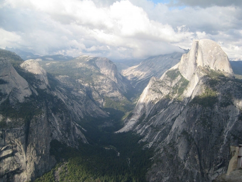 The Sierra Nevada Research Stations lie within the heart of the Sierra Nevada, an asymmetric mountain range with gradual western slopes and steep eastern crags. The entire range is 80 kilometers (50 miles) wide and 640 kilometers (400 miles) long. Yosemite's highest peak, Mount Lyell, reaches 3,997 meters (13,114 ft). The highest peak in Sequoia National Park is Mount Whitney, with an elevation of 4,421 meters (14,505 ft). In the Sierra Nevada, granitic rock dominates the landscape. The dramatic granite formations of Yosemite played a significant role in securing National Park status for the area, and they continue to inspire millions of visitors to come and experience Yosemite's breathtaking beauty.
In the Sierra Nevada, visitors encounter a prodigious exhibition of granitic rock, a type of intrusive igneous rock that forms as molten rock slowly cools deep underground. Insulated from the relatively cold air at the surface, the minerals cool and solidify slowly. 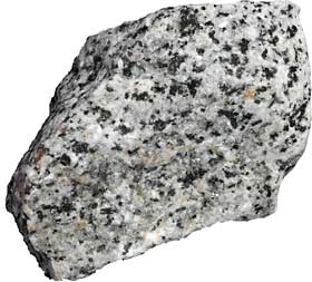 This slow solidification allows the minerals to develop crystals that are easily seen. Generally, the slower the magma cools, the larger the crystals will be. The speckled “salt and pepper” appearance of granite results from a mixture of five main crystallized minerals. The lighter minerals are quartz, orthoclase feldspar, and plagioclase feldspar. The darker specks are mainly biotite and hornblende. Small amounts of the minerals titanite and zircon can also be present. The variable proportions of light to dark minerals found in these rocks result in a fantastic mosaic in an endless sea of granite that helps to distinguish different masses emplaced at different times.
The Geologic Story of the Sierra Nevada
|
Geologists now believe that the outer shell of the earth is made up of rigid plates that very slowly move around over time. The plates consist of oceanic crust (which is relatively thin and dense) and continental crust (which is thicker and lighter than oceanic crust.
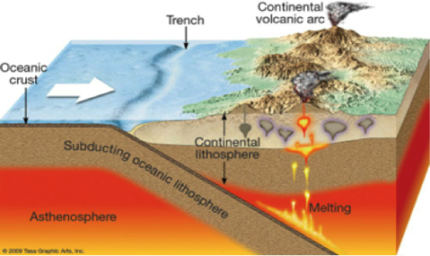
When 2 plates collide together, one plate often goes down beneath the other plate in a process known as subduction. This subducted plate carries seawater down with it. This water gets superheated deep in the earth, and as it rises upwards, it lowers the melting point of the surrounding continental rocks, causing them to melt. |
The developmental history of the Sierra Nevada has been written and re-written multiple times as new evidence is unearthed and brought into the light. Some of the oldest rocks in the Sierra Nevada are over 450 million years old and are made up of ancient ocean bottom sediments and sub-marine volcanic rocks. The origins of the amazing granitic rocks of the Sierra Nevada can be traced back to about 220 million years ago. At the time, the land of modern-day California lay at the western edge of the ancestral North American continent, which was in the slow process of moving northwest from its previous location in the tropical latitudes towards its current position. At about 215 Ma, eastward dipping subduction (see box to left) took over as the eastward-moving Farallon plate began to descend below the North American plate, right in the region where the present day Sierra Nevada is located. During subduction, as the Farallon plate descended into the mantle, chemical and physical changes resulted in the overriding ancestral North American plate melting. This molten rock rose through the crust in multiple pulses over a period of 100 million years. Some stayed in place, forming large bodies of cooling granite (plutons) two to 10 miles below the Earth's surface. Some reached the surface, creating a north-south chain of volcanoes standing as tall as 7,000 meters (20,000 ft) high. These volcanic mountains were then extensively intruded with more rising magma. As the granitic plutons cooled, these hot magma intrusions metamorphosed the rock that they intruded into. Today, the Sierra Nevada batholith is made up of many plutons throughout the range. Most of this granitic rock formed between 105-85 million years ago, with pluton emplacement ending about 70 million years ago.
When the subduction-fueled mountain building ended, the processes of erosion took over, slowly exposing the Sierra's granitic core as the surrounding rock and volcanoes wore away. Most of the volcanic rock eroded between 85-15 Ma. Erosion wore away much of the volcanic cover and metamorphosed country rock, eventually carving into the newly-exposed subsurface granite. Streams carried the eroded sediments downstream to the west and deposited them in California's Central Valley and the area of the Coast Range (which was not yet formed), where they remain today.
Volcanic activity subsided between 65-15 million years ago. Evidence indicates that early in this period, the ancestral Sierra Nevada reached heights greater than 2,800 m (about 9,200 ft). Despite this, it was actually lower in elevation than the land to the east, a previously mountainous region referred to as the Nevadaplano. Tectonic processes eventually led to the subsidence of the Nevadaplano, forming the Great Basin, a low elevation region that now lies in the rain shadow of the Sierra Nevada.
About 30 million years ago, the eastward-moving Farallon plate started to be completely engulfed beneath the 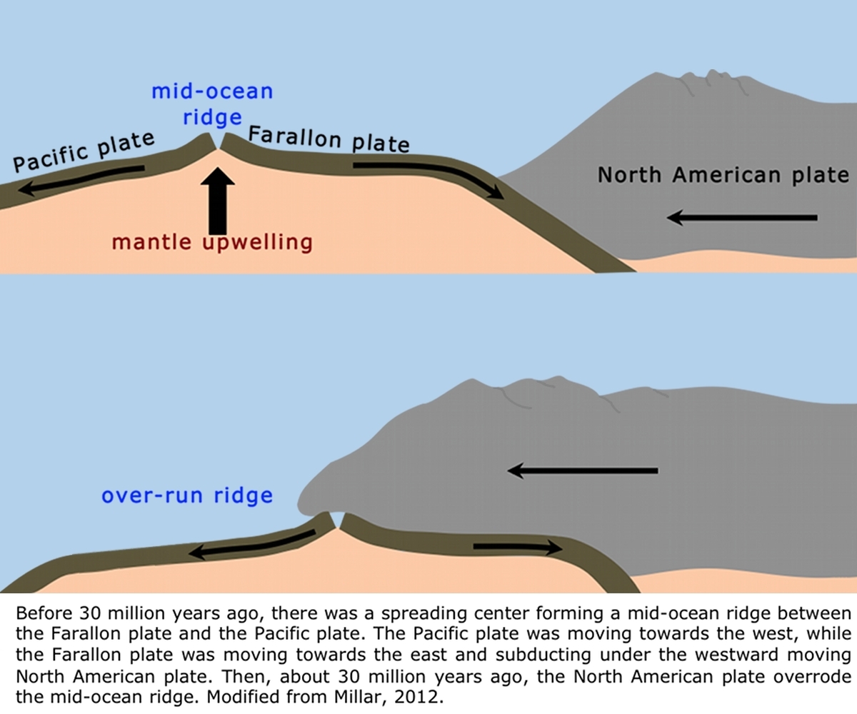 westward-moving North American plate. The North American plate now was overriding the spreading center that marked the boundary between the Farallon plate and the Pacific plate. Unlike the Farallon plate, the Pacific plate did not move eastward towards the North American plate. Instead, it moved northwest, which was in the same general direction, but slightly more northward, as the North American plate. This resulted in the formation of a strike-slip boundary (horizontal motion, with the west side moving northward relative to the east side) that developed into what is known today as the San Andreas fault.
Roughly 15 million years ago, volcanic activity resumed in the Sierra Nevada, north of Yosemite. This period of volcanism formed tall volcanoes and buried ancient river canyons. Some of the ridges formed from this volcanic activity can be seen from the road in places like Sonora Pass (north of Yosemite National Park).
Around 10 million years ago, the Sierra Nevada started to experience renewed uplift, faulting, and westward tilting. This, in combination with the sinking of the adjacent Nevadaplano, exposed new rock surfaces.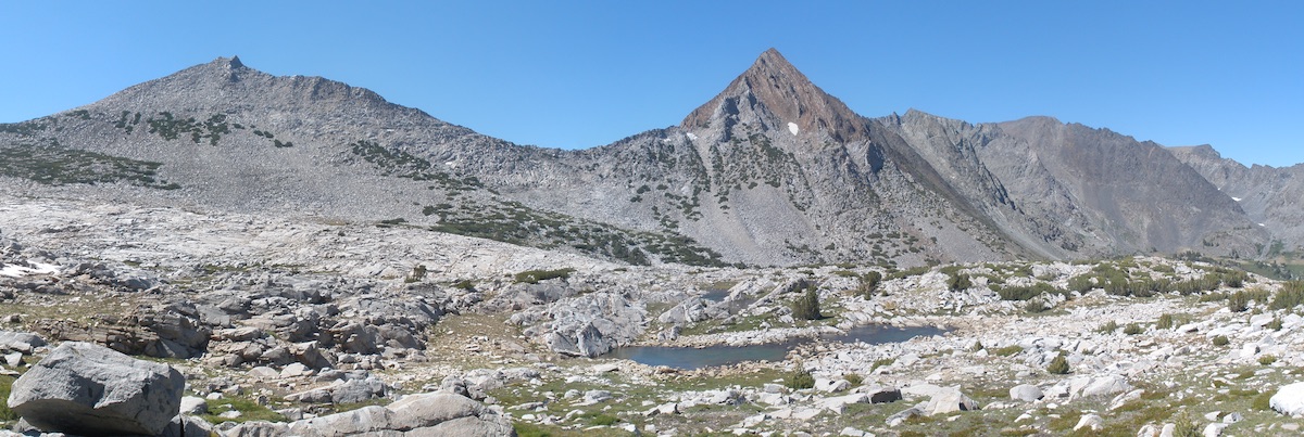 Erosion quickly went to work on these surfaces, revealing even more of the ancient granitic and metamorphic rocks that had formed more than 85 million years ago. A great place to see this ancient, exposed rock is near the head of Virginia Canyon and in the vicinity of Tioga Pass and Saddlebag Lake.
About 2.6 million years ago, tectonic activity was 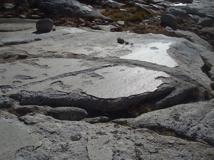 continuing to shape the southern Sierra Nevada. However, a cooling Earth allowed a new erosive force to emerge: glaciers. Between 2.6 Ma and today, more than 40 cycles of glacial (cold) and interglacial (warm) periods have elapsed, each lasting between 40,000-100,000 years. Glaciers formed in the Sierra Nevada and in the surrounding mountains during these glacial periods. Slow-moving glaciers proceeded to sculpt the landscape, leaving behind trailing moraines, jagged horns, narrow arêtes, U-shaped valleys, and other distinctive formations.
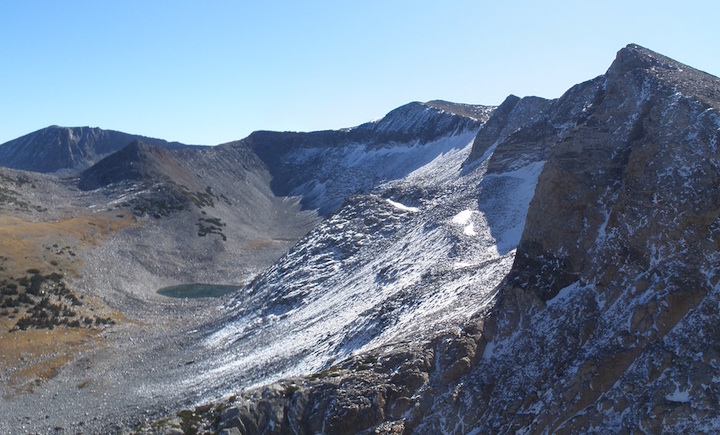 Examples of glacial formations in the Sierra Nevada abound for those willing to learn how to recognize them and seek them out. Matterhorn Peak is Yosemite's most famous glacial horn. It was left behind when glaciers surrounded and scoured the lower slopes of this high peak. Lyell Canyon is a classic example of a U-shaped canyon with its flat bedrock floor and steep walls. It formed when a glacier slowly passed through and widened a preexisting V-shaped valley. Yosemite Valley is a more well-known U-shaped valley; however, it is not the best example. While glacial activity did help shape Yosemite Valley, it also partially owes its flat floor to sediment deposition. Nevertheless, it is still worth hiking up to Inspiration Point above Yosemite Valley
 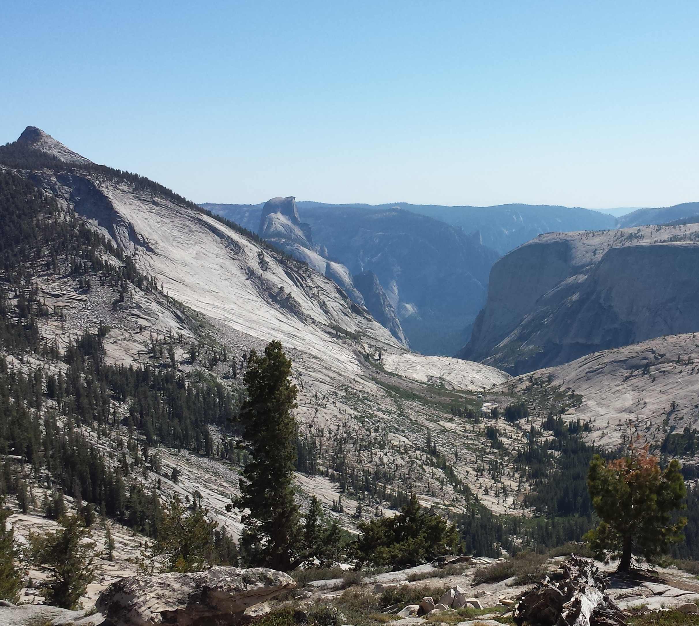 to behold the panoramic view that has enraptured the hearts of millions.
More Information
National Park Service—Granite: http://www.nps.gov/yose/learn/nature/granite.htm
National Park Service—Sequoia and Kings Canyon Geology Overview: http://www.nps.gov/seki/learn/nature/geology_overview.htm
Geologic Maps of Yosemite National Park and Vicinity, and of Yosemite Valley:
http://www.yosemite.ca.us/library/geologic_story_of_yosemite/maps.html#plate_2
Bird's Eye View of Yosemite Valley with selected landforms identified: http://www.yosemite.ca.us/library/geologic_story_of_yosemite/images/18.jpg
Resources
Schoenherr, Allan A. 1992. A Natural History of California. University of California Press: Berkeley.
Millar, Constance I. 2012. Geologic, climatic, and vegetation history of California. In: Baldwin, Bruce G.; Goldman, Douglas H.; Keil, David J.; Patterson, Robert; Rosatti, Thomas J.; Wilken, Dieter H., editors. The Jepson Manual: Vascular Plants of California. 2nd Edition. University of California Press. pp. 49-67. Available: http://www.fs.fed.us/psw/publications/millar/psw_2012_millar003.pdf
Glazner, A.F. and Stock, G.M. 2010. Geology Underfoot in Yosemite National Park. Mountain Press Publishing Company: Missoula, MT.

